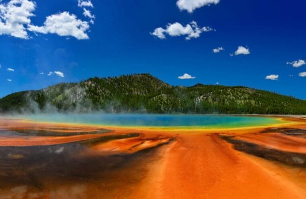
In the heart of Wyoming lies Yellowstone National Park, a sprawling wilderness that stretches over 2.2 million acres. Beneath its scenic landscapes lies a hidden force of nature—the Yellowstone Supervolcano. This behemoth is one of the largest active volcanic systems in the world, extending across an expanse of 28 by 43 miles.
It derives its power from a subterranean magma chamber, an infernal reservoir estimated to span 50 miles by 25 miles and as deep as 9 miles into the earth’s core.
The last three major eruptions at Yellowstone occurred approximately 2.1 million years ago (the Huckleberry Ridge Tuff eruption), 1.3 million (the Mesa Fall eruption), and 631,000 years ago (the Lava Creek eruption), shaking the very foundation of the land and leaving their mark upon the park.

Historical and Ongoing Earthquake Activity at Yellowstone
While the Yellowstone Supervolcano has slumbered peacefully in recent times, the active supervolcano possesses another, more likely, threat with the potential to unleash destruction—colossal earthquakes.
Within the bounds of Yellowstone, a symphony of quakes plays out each year; between 700 and 3,000 of these minor quakes ripple through the earth’s crust, often too faint for human perception.
Yet, there are moments when Yellowstone’s movements grow bolder.
In 1959, an earthquake of magnitude 7.3 struck the park, wreaking havoc and remolding the landscape. This dramatic event, known as the Hebgen Lake earthquake, was a testament to nature’s unrestrained power, as the shifting ground obstructed the flow of the Madison River, creating a 170-foot-deep lake in three weeks – now known as Quake Lake.
Those alive to witness the 1959 earthquake – described a shocking scene; Joann Smith, who was 11 years old at the time, said to the Denver Post, “It was frightening. It was horrible … you could actually see the ground open up.” A subsequent landslide swept through a campground, killing over two dozen people.
According to Outside Magazine, significant destruction also occurred to properties in the area, “the summer houses stationed along Hebgen Lake sustained shifted foundations, crumbled chimneys, and burst pipelines. Roads cracked and shifted, and three of the five reinforced bridges located near the quake’s center were severely damaged. Large portions of nearby forests were destroyed.”
The Hebgen Lake earthquake was ultimately caused by one of many faults related to the Basin and Range extensional province, which stretches from eastern California into western Wyoming. According to the United States Geological Survey (USGS), similar strong earthquakes will happen in the future.
The National Park Service details that most earthquakes at Yellowstone occur in swarms— meaning they are close together in time and space.
A swarm was the case most recently, in June of 2017, when a cluster of over 800 earthquakes occurred over the span of two weeks, with the largest registered quake in the group hitting 4.5 in magnitude.
The Guardians of Yellowstone
In the face of these awe-inspiring events, the United States Geological Survey (USGS) stands as a stalwart observer, surveying the seismic and volcanic activity within Yellowstone National Park.
The USGS employs an array of scientific instruments—a network of seismometers, GPS stations, and cutting-edge monitoring technology to track Yellowstone’s Supervolcano and, for now, believes it will remain quiet from volcanic activity.
However, according to USGS, it is “far more likely [that events] on human timescales [will be] damaging earthquakes and hydrothermal explosions.”
While the USGS does its best to monitor activity at Yellowstone, it cannot be sure when the next swarm of earthquakes will hit. Another large shock from the Basin and Range extensional province fault could cause damage all the way to California — a state situated along the Pacific Ring of Fire, a highly active seismic zone.
Don’t wait for the next swarm of Yellowstone quakes to protect your home from destruction. Get a quote from QuakeInsurance by Geovera today.


