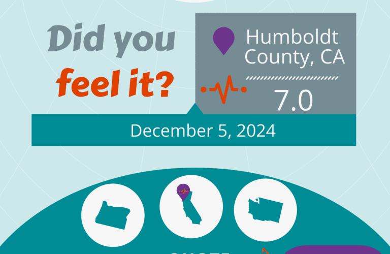
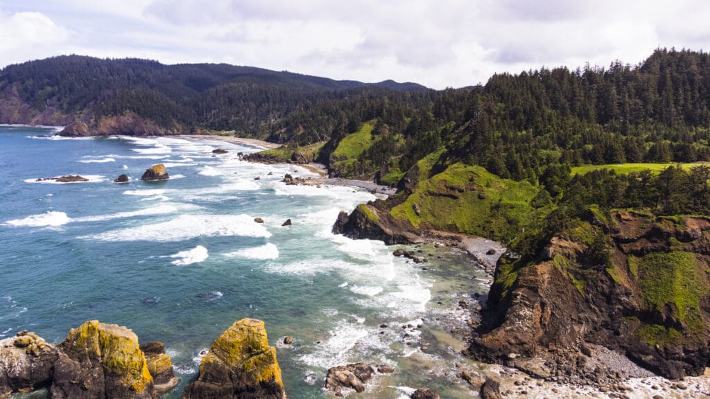
The Pacific Northwest, particularly the coastal regions of Washington and Oregon, is known for its breathtaking landscapes and diverse flora and fauna. However, beneath this picturesque scenery lies a significant seismic threat. The Washington-Oregon coast is part of the Cascadia Subduction Zone (CSZ), a major fault line that has the potential to unleash devastating earthquakes.
The Cascadia Subduction Zone: An Underwater Ticking Time Bomb
The Cascadia Subduction Zone extends from Northern California to Vancouver Island in Canada. This 620-mile fault line is where the Juan de Fuca Plate is being forced under the North American Plate. This subduction process causes tremendous pressure to build up over time, which can be released as earthquakes.
Scientists have determined that the CSZ is capable of producing “megathrust” earthquakes with magnitudes of 9.0 or higher. These events can cause severe shaking, massive tsunamis, and widespread destruction.
According to a study by the Oregon State University, there is a 37% chance of a magnitude 8.0-8.6 earthquake occurring in the next 50 years, and a 10-15% chance of a magnitude 9.0 event.
Today, the Cascadia Subduction Zone remains unsettlingly quiet. Unlike other subduction zones where small earthquakes occur frequently, making them easier to map, this area shows minimal activity, according to Carbotte.
Scientists have several theories to explain this phenomenon and suggest that the zone may be becoming quieter as stress builds up along the fault. As a result, we are likely approaching the time for a significant earthquake.
Historical Context
Evidence from geological studies, such as sediment layers and tree rings, indicates that the last major earthquake on the CSZ occurred on January 26, 1700. This event, estimated to be a magnitude 9.0, caused a tsunami that reached as far as Japan. Given that significant earthquakes on the CSZ occur approximately every 300 to 500 years, the region is currently within the window for another major event.
Recent Studies and Predictions
Scientists have partially pieced together the event’s history using centuries-old records of tsunamis, Native American oral histories, physical evidence in ghost forests drowned by saltwater, and limited maps of the fault.
But no one had mapped the fault structure comprehensively — until now. A study published in June 2024 in the journal Science Advances describes data gathered during a 41-day research voyage in which a vessel trailed a miles-long cable along the fault to listen to the seafloor and piece together an image.
The team completed a detailed map of more than 550 miles of the subduction zone, down to the Oregon-California border.
Their work will give modelers a sharper view of the possible impacts of a “megathrust” earthquake there — the term for a quake that occurs in a subduction zone, where one tectonic plate is thrust under another. It will also provide planners a closer, localized look at risks to communities along the Pacific Northwest coast and could help redefine earthquake building standards.
“We have the potential for earthquakes and tsunamis as large as the biggest ones we’ve experienced on the planet,” said Tobin, who is also a University of Washington professor. “Cascadia seems capable of generating a magnitude 9 or a little smaller or a little bigger.”
Potential Impact
A quake that powerful could cause shaking that lasts about five minutes and generate tsunami waves up to 80 feet tall. Major cities such as Seattle and Portland would face significant damage to infrastructure, including bridges, roads, and buildings. It would damage well over half a million buildings.
The impact of a CSZ earthquake would be catastrophic. Coastal communities in Washington and Oregon could experience intense shaking lasting several minutes, followed by a tsunami with waves potentially exceeding 30 feet.
The economic ramifications would be substantial, with estimates suggesting losses in the hundreds of billions of dollars. Recovery efforts would be extensive, requiring years of rebuilding and support.
Preparedness and Mitigation
Efforts are underway to mitigate the risks associated with a CSZ earthquake. The Pacific Northwest Seismic Network (PNSN) is expanding its network of sensors to improve earthquake detection and provide early warning. These early warning systems can give residents crucial seconds to take cover before the shaking starts.
On an individual level, residents are encouraged to prepare emergency kits, develop family communication plans, and participate in earthquake drills such as the annual Great ShakeOut. Communities are also working to retrofit older buildings and infrastructure to withstand seismic forces better.
The earthquake risk along the Washington-Oregon coast is a serious concern that requires ongoing attention and preparation. While the beauty of the Pacific Northwest draws people to this region, it is essential to remember the seismic risks that come with it. By understanding the threats and taking proactive measures, residents and authorities can work together to minimize the impact of a future Cascadia Subduction Zone earthquake.
Preparedness is key. As the adage goes, “Hope for the best, but prepare for the worst.” In the context of the Washington-Oregon coast, this means staying informed, ready, and resilient in the face of an inevitable natural disaster. Check out www.quakeinsurance.com to learn how you can protect yourself from the unexpected and for an earthquake insurance quote in under a minute.